Case Studies

Learn how Transconomy has helped industry professionals, just like you.

Learn how we helped transportation professionals solve their problems.

RCRPC image
Richland County Regional Planning Commission

Pavement Assessment/Inventory Survey and Safety Project

The scope encompasses a pavement condition survey for over 2,200 lane-miles and an asset inventory and condition survey for more than 2,800 lane-miles. The asset condition survey consisted of sidewalks, traffic signs, pavement markings, and line striping. The project scope included rural, suburban, and urban areas. The project unfolded across several phases. Our project management approach involved constant and consistent communication through a kickoff and bi-weekly project status meetings. This project leveraged Transconomy’s entire ecosystem for data collection, data processing and data visualization as well as the ESRI ecosystem. Data collection consisted of Transconomy personnel driving the entire system capturing right-of-way imagery using our Transconomy Collector application supplemented by other high-resolution cameras.

element
casestudy kimleyhornassociates@2x e1644236014784
CITY OF LONE TREE, CO

Traffic Sign Inventory

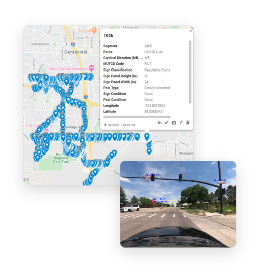
Transconomy and Kimley-Horn recently joined forces to create a traffic sign inventory and sign condition database for the City of Lone Tree, Colorado. Staff at Kimley-Horn collected about 100 lane-miles of the street imagery using a Go-Pro camera with instructions provided by Transconomy team to ensure quality and consistency for data collection. Nearly 50,000 Images were then uploaded to the Transconomy Hub, where the Transconomy AI algorithm was executed. These raw images were automatically processed to identify assets, remove duplicate assets in consecutive images, and geo-tag asset locations on a map. The software also provides the GIS-based asset inventory in Shapefiles (SHP) for use in Esri applications and Keyhole Markup Language (KML) files for use in Google applications.
element
Transconomy Case Study Summary Image TranSystems e1644403293968
US-400 AND US-69 IN KANSAS

Pavement Marking Inventory

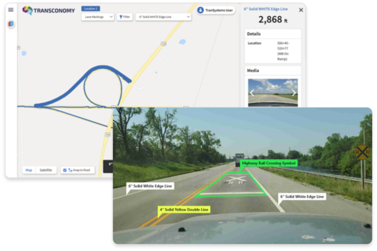
TranSystems teamed up with iENGINEERING in a joint effort to create a comprehensive pavement marking inventory for the Kansas Department of Transportation (KDOT). TranSystems collected 64 lane miles of roadway image data using the Transconomy Collector mobile app. At the end of the data collection, Transconomy Collector automatically synchronized around 3,500 geo-coded images to the cloud (Transconomy Hub) for data processing and asset extraction. Advanced AI algorithms were used to extract lineal lengths of pavement markings and quantities of symbol markings to create a comprehensive asset inventory. The inventory results were integrated into Transconomy Viewer to provide data visualization along with comma-separated values (CSV) and Keyhole Markup Language (KML) formats.

element

We would love to chat with you about your asset inventory needs.