
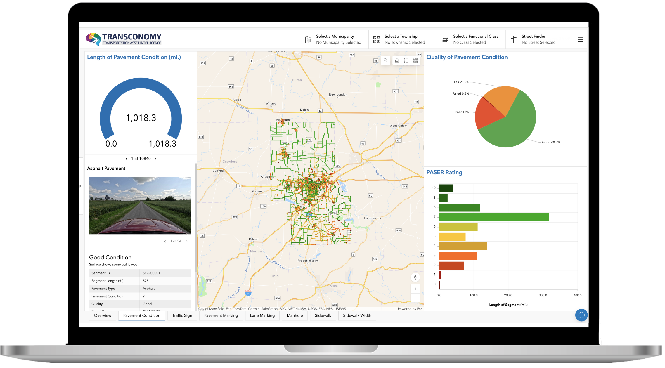
ArcGIS Dashboard
Transconomy can deliver your asset data in an ArcGIS Dashboard, offering customizable quick filter's, meticulously designed to cater to your specific needs, empowering users to effortlessly visualize transportation assets on interactive maps. With intuitive filtering options and effortless navigation.
Streamline your data exploration process and gain instant insights into critical traffic asset inventory and performance metrics. Our application's interface ensures effortless navigation.
Heat maps, charts, and graphs powered by interactive dashboards facilitate collaboration among stakeholders. Comprehensive views of your transportation assets and performance metrics foster transparency and informed decision-making for asset management.

ArcGIS Experience Builder
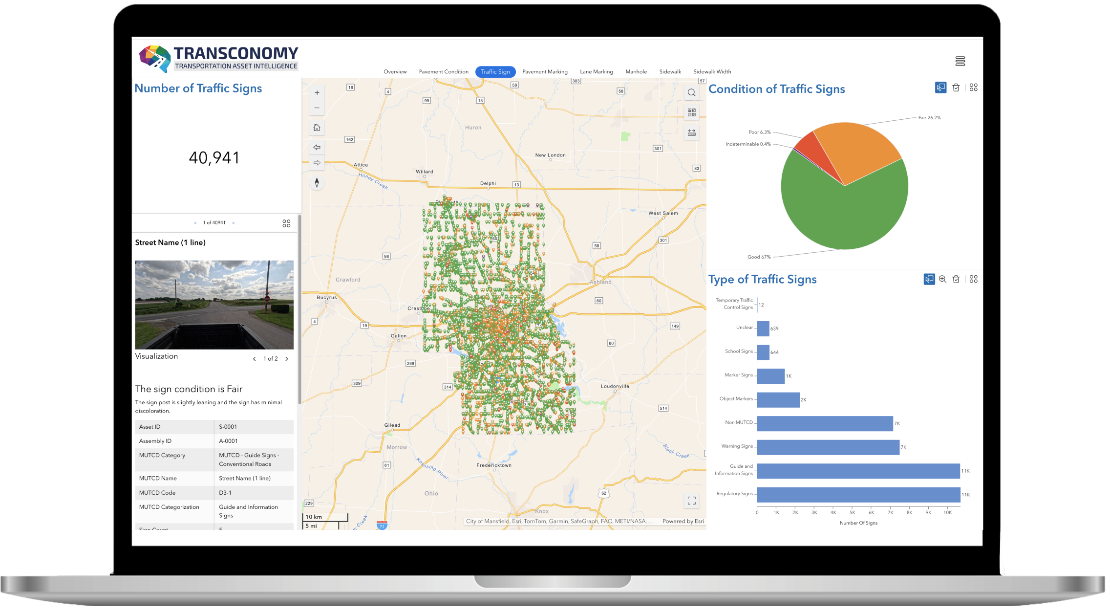
Enables precise data querying, filtering, and aggregation for comprehensive analysis and informed decision-making.
Easily export maps, charts, and data in PDF, Excel, CSV, and geodatabase formats for seamless sharing and integration with reports tailored to organizational needs.
Integrates smoothly with ArcGIS Online, ArcGIS Enterprise, and external systems, ensuring data consistency and interoperability.
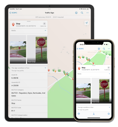
ArcGIS Field Maps
Fully take advantage of Transconomy's critical transportation asset information anytime, anywhere, with the mobile-friendly design of ArcGIS Field Maps, empowering field workers with essential data on the go.
Navigate through traffic asset data with ease using the intuitive mapping interface of ArcGIS Field Maps, providing clear visualization and easy access to critical information.
Increase productivity by fostering collaborative workflows with ArcGIS Field Maps. Leverage its powerful capabilities to streamline asset inventory and management processes, while facilitating seamless communication and coordination among teams working on asset-related tasks and projects.
Maintain productivity even in areas with limited connectivity by utilizing the offline capabilities of ArcGIS Field Maps, allowing field workers to access and update asset information regardless of network availability.